Nature-ral High

Nature-ral High
Do not follow where the path may lead. Go, instead, where there is no path and leave a trail

October 23, 2010

Mt. Kanlaon

No, I'm not in hiatus. There were just so many changes in my life (for the better) that I got too busy to write in my blog. It has been more than a month since my last climb. This mountain is Mt. Kanlaon in Negros Occidental.
There are several trails in Mt. Kanlaon. You can climb via Wasay - Guintubdan, Guintubdan - Guintubdan and the unregulated Makawili trail. For us we used the Wasay - Guintubdan trail, though considered the most difficult, it is known to be the most rewarding. The trail normally starts in Mambucal resort, climbers usually stay here for an overnight and climb the next day. But for us, we opted to stay in the Rangers (Bantay Kanlaon) house. The place was around 30 minutes from Mambucal, its also the rangers place where we did the preparation for the climb of the first day.
The first day of climb started on a wide rocky road and immediately went on assault. After a few hours of walking will lead you to the PNOC private road. The elevation continued to rise until we reach around ~1300MASL. At this height I think we continually hiked for 3-4 hours. Put into consideration that there were four or five river crossings. Hiking up and down with the ground having very loose soil. Early on this part, my wifes shoes shows signs of retirement. Proof how difficult the trail was. At the end of the first day we reached the Junction camp. Very beautiful camp and spacious. It can be compared to Camp Goody of Mt. Apo but much much better.


early trail


limatik

Continuing our trek the next day involves passing the mossy-iest part of the mountain. Heck, I think this is the mossiest part of the Philippines! The trail involves passing into ardous space that we called hobbit holes. Its just like there were hazzards that you need to be nd then crawl then twist then immediately step up. Whew! But the forest was so mesmerizing, it seems to be untouched that lifts up your spirit removing your tiredness. You can compare this to the mossy t
rail of MakTrav, but also much much better. Adding beauty to the trail was that there are several Lakes, that had been named from the Mountaineering group that discovered them. Among them were PMS, SAMOK etc. There was also Harding Sangbalo (Garden of a Widow) which was also undescribable. similar the first day, when we reached around ~2100MASL we hiked for 3-4 hours with the height declining or rising. There was also a part that has 90 degrees inclination, adding difficulty was that the soil was also very loose. I think the only consolation here was that though the limatiks were abundant, they were not aggressive. We Camp at the Easter Saddle Camp that was just a few minutes away from the summit/crater.

Beautiful Harding Sang Balo


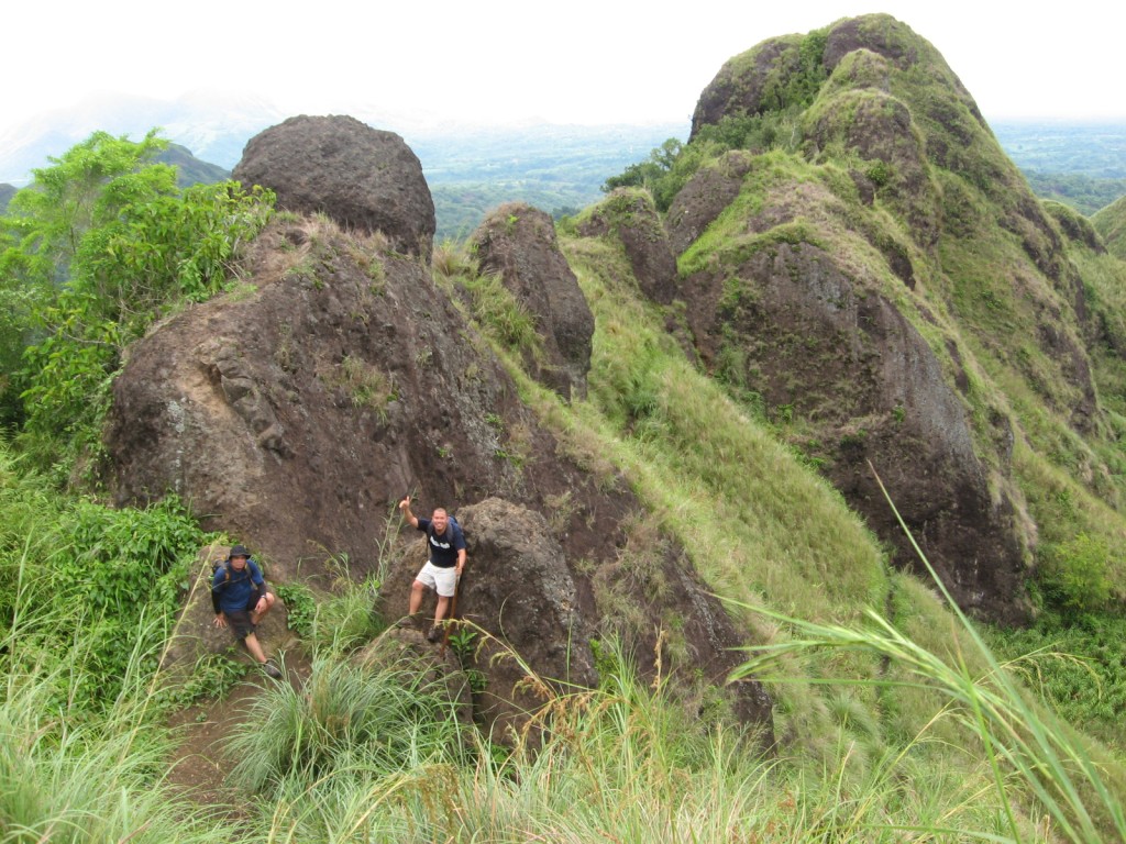
The trail was zig-zag!


Mossy isn't it?


90 degrees climb


Samok lake


Moss garden (my watch as the reference)


PMS lake


View from PMS lake


The other group in Margaja valley


The next day was the plan to see the summit/crater. But since it rained the previous night, there was no clearing! But thank God around 9am the wind stops and the cloud cleared! We had clearing and theres was sea of clouds! We enjoyed the s ummit (though very scary) took pictures then decided to go down. The first two days was via Wasay trail, the 3rd day was Guintubdan trail. Though the early part was similar to the Wasay 2nd day, the rest was just complete flat hike. But the trees was still very thick and tall. The time then was just 2pm it was as dark as 5pm! We reached the Guintubdan jumpoff still ahead of our schedule. Bragging aside, the locals was so amazed to s
ee us they called us 'DASIG'. Whats DASIG? Its for you to find out :P.


Summit at the background


Onward to the summit!


Sea of clouds?


Margaja Valley
Summit view while going up


The crater was a big "whoaaa"!!!


Cris peeking at the crater


Sitting beside the crater.


Steep huh?


Girls of team Dasig


Team Dasig!


Smiling above the clouds


Height in MASL, Margaja at the background


Going back to the campsite

Goodbye trusty shoes, and thanks Barry for the ductape.


A mountain, view from the airport.


I considered Kanlaon as one the climb I like the most, but also one of the most difficult. One factor adding to the difficulty was that you have to climb full packed for three days, and since most of your food supplies is with the guide/porter. Your load doesnt get light as the trek progresses. And because its a traverse, theres no way for you to leave some of your personal things. Its difficult but was very rewarding. Its not just the mountain that was perfect but the company (Go team DASIG!) the timing and the weather. And what a way to end our hike but with an INASAL dinner in Manokan Country of Bacolod. It has the best INASAL I have ever tasted. And my American friend can attest to that.


September 7, 2010

Mt. Cinco Picos

I had been monitoring the Tropical Depression (TD) forming up last friday (Sept27). I am worried that it might enter the Philippine area of responsibility. Luckily, the storm which started in the South China Sea was heading WNW and base on my knowledge of Philippine storms if they are headed that direction they would'nt go back unless is pushed by a more powerful typhoon.


Having this information, I decided to push through with our Mt. Cinco Picos climb. If you had been following my blog, Cinco Picos is one of the popular mountains in the Cawag settlement so the jumpoff is just the same. cinco Picos got its name for having five peaks if you view it from a distance. But only three peaks have been scaled, and currently only two can be reached. Though the TD was outside the PI, I am expecting there will be rain. The first hurdle is crossing pinaglabanan river. The rain from previous night had caused it to swell that its normal size. Fortunately there was another group who were also climbing Cinco Picos, they brought in ropes and we were able to cross the river with them. I believed the river can be crossed un-assisted, but its still safer if you had something to hold on to. Thanks to the U-Trek for lending us a hand.


After the river was mostly wide trails that according to our guide was created for mining. Its basically flat trail that is carved in the bottom-mountain side, with several brooks along the way. Looking around, will give you the grand view of the mountains along the area.And because its the rainy season, everything is colored green. Constrasting when its summer that everything is brown.


After a short river trail, you'll go around peak1 and then do an assault of peak2. The trail is very slippery due to moss, surely its more difficult going down. A few minutes of flat walk after the assault of peak2 we reached the campsite. Its a lot smaller compared to Balingkilat, but its not that open and there are a few trees to block the wind coming from the sea. We arrived at the campsite around 2pm and at 3pm started to rain on/off until morning. From what I know Silanguin cove can be seen from the campsite, but its very foggy so theres no visibility. The guides told us that Peak3 (summit) cant be climb. Rarely climbers go there and the trail is not that established. They said also that it might take another day just to go to the summit.


The trail


The view


Onwards to Peak2 summit


Summit shot


Because of the all night rain, the senior guides advised us to take the less taken hunters trail(our guide was a kid). But after going down peak2, it became sunny. So we opted to take the traditional trail. Our analysis was correct, even pinaglaban river was smaller compared to yesterday. We were even able to take a dip before heading back to the jumpoff.


After the rain


Group shot


Meditating


Swelled Pinaglaban, but still not as big as Yesterday

In two weeks we are heading to Mt. Kanlaon, the Kanlaon climb was actually the purpose of this climb (training climb). And with the rain in all, I guess I was able to push ourselves the limit. So whats next? I plan organize another Cinco Picos climb but one that will traverse to the untouched Silangin Cove. A few have done it so I think its time to do it before it become another Anawangin and Nagsasa.


August 13, 2010

A Mountaineers Level

If you had been climbing for quite a while, its quite obvious that you are developing skills in hiking. But of course its still defends on how much you are willing to put yourself to the next level. Meaning if you are climbing for say ten years now but its just around the Batangas-Cavite minor mountains, your skill will plateau just to a minor extent. Two years of climbing on Major mountains is better skillwise compared to the latter.

Given these scenarios, I had compiled the Mountaineers skill levels basing on how much he had honed his skills and physical prowess.

Level 1 - Normally this is a beginners level. When you start climbing probably on a dayhike and then simple overnights trips to minor mountains like Mt. Maculot or Mt. Manabo. If you had been on level 1 for quite a while, you may also have the ability to organize a minor climb (advance level 1).

Level 2 - This is the time when you have the urge to explore mountains which are more that 1000++ masl or so. So if you have climb Major mountains like Mt. Pulag (akiki or tawangan trail), Mt. Banahaw or Mt. Apo, you are a Level 2. You can add that an advance Level 2 hiker is the one that have tried mountains that needs technical skills. There are a few mountains that has this, but it still needs to be put into consideration. Mt. Guiting-guiting is considered technical but doesnt need ropes erstwhile Mt. Banahaw is not technical but there are a few parts that use ropes.
And the more advance a level 2 hiker is, the more ability he has to a climb farther away of his comfort zone.

Level 3 - One of the traits of an outdoorsy person is that you want to share what you see or experience. So the next level after climbing major mountains is to organize a climb, Both a minor and major. From organizing a simple dayhike to multi day trips requires a Level 3 skill. Here is also where Leadership potential comes in. By going through the previous levels (1 and 2) will also give the climber the idea on how to take care of Nature and he should know LNT (leave no trace) outdoor ethics by heart. You should also should know how to blend to the locals, and have haggling skills in getting your logistics. And like the previous level the more advance a level 3 hiker is, the more ability he has to organize a climb farther away from his comfort zone.

Level 4 - So whats next after organizing? Exploring! This is the time when you create trails for mountains that had never been climb by hikers. This requires a lot of skills (and money) since you might need the help of the locals around the area. Proper planning is also need and most of the time, a single climb will not achieve your goal. There are also time that your resources and supplies might deplete untimely and survival skills comes into play. Mt. Ugu climb was pioneered by PALMC, Mt. Balingkilat by YABAGMC and Mt. Guiting-guiting by the group of Art Valdez. The more advance a Level 4 is, the higher the mountain he can explore. And the farther also from his comfort zone.

Level 5 - Alpinism. When you climb mountains that your not familiar with. And ideally when you try to climb snowcap mountains. This mountains cannot be found around the Philippines and nearby south east Asian countries. Being a tropical country, we are not climatize to coldness. So to climb this mountains (Mt. Hood, Mt. cook or Mt. Denali) will need extra training (e.g ice climbing) and of course money.


This leveling is just base on my idea and is not official. And of course this is base from a tropical place point of view. So if you live in an area where you are alread use to snowcap mountains, this leveling is not applicable.

August 12, 2010

Mt. Balingkilat Traverse


Rainy season is here, its normally off season for hikers. But that is like half a year of no climbing? I thinks, its still okay to continue climbing during this time given that there is no severe weather disturbance.
Thats why last July 24, even the weather being glommy we opted to go to the most popular hiking destination in the Aeta Cawag settlement. Mt. Balingkilat - short for "Bahay nang Kidlat" (Home of Lightnings).

From the jumpoff the trek starts passing by the aeta houses until you reachead the "kawayananan" pit stop. About two hours from the jumpoff, this place is where hikers have their lunch and rest a bit. After kawayanan is where the fun begins.... its the start of complete assault trek. Its hiking on a trail which is 70-80 degrees incline. The trail is composed of cugon grass, scattered limestones and I almost forgot loose soil! Opposite Balingkilat (early part of the trail) is a hill, which blocks the wind. You may compare this part to a valley. This also adds to the difficulty of the hike since the place becomes very hot and humid. I can't imagine climbing here during summer. The ventillation only becomes better when you reach the height of about 700-800masl. When your almost at the plateau of Balingkilat, the trail becomes more narrow and more dangerous. I was asking myself, why didnt the group who created the trail made it a bit easier (zig-zag) and not complete assault? Well, the mountain had eroded a lot (there is no trees here) and this is apparently the best trail to create.


The valley Like Trail


rest stop

Upon reaching the plateau after roughly 3++ hours hike, its just an easy walk or around 15 minutes to reach the campsite. But we choose to wait for our companions who were left behind [angry smiley]. Bad bad idea because after half na hour or so it started to rain. We pitched our tent under heavy downpour. The rest of the night rain was off and on. But early in the morning there was good weather. We took this chance to have a good look of the area, from the campsite you can see the nearby mountains in the area (nagsasa, etc) and the far away coves/beaches (subic bay etc). You can also see the summit only about 15 minutes away. One thing amazing about this mountain is that there is a river on top (beside the campsite), which is also the water source. We took advantage of the clear weather to cook and have our meals. And then the sky closed... and the weather turn bad to worse. It was raining so hard that we settle to cancel our summit assault. We were hoping to wait the rain to stop, but it just would not. Thats the time I decided to break-camp, and just move out from this rain cloud.


Subic Bay, summit view


river beside campsite


campsite, afar is the summit

Since the trail is very steep going-up, imagine how it is after this rain. This is also the time I decided to take the traverse trail. The traverse trail had been taken by other climbers a few times, plus the hunters. Its not yet established but I know its possible. With our guide leading we took this trail, early on my mind was debating If I made the right decision. The early part of the trail was very steep,grassy, full of twigs and has loose rock and soil. But after about 30% of the trail, it became for more level and just a bit rolling. I guess its still safer than if we took the traditional trail. After 2 hours of hiking down, we reached the Nagsasa ridge. From here its an easy way going back to the jump off. We also try to pass by Pinaglabanan river but it was overflowing, guess its better to dip here during summer. Next stop.. Cinco Picos.


the traverse route, summit view


traverse route


bundok Dayungan (cloud covered) and Mt. nagsasa (left partially seen)


July 7, 2010

Mt. Batulao (Unplanned)

Every end of the year the sun sets around the peaks of Mt. Batulao. This creates a grand illusion of rocks lighting up. The locals calls it "Bato sa Ilaw" (Rocks within Light), which later became Batulao.

A climb friend who was vacationing from Canada asked us to organize a climb for him. Since he was on tight schedule we decided to go to Mt. Batulao on a day hike. Just a recap, the jumpoff to this mountain starts at Evercrest Golf course, upon proceeding you past by Barangay roads which is dusty in summer and muddy in the rainy season. The reason for this is that the locals also use this road for their livestock (cows, horse etc). We even saw several transporstation horses carrying several sackloads of indian mangoes. After this road next is the rolling trails that leads to the fork of the new and old trail. There are a few huts along this route that I believe sells buko during the peak climbing season (theres none during our climb).
We initially planned to take the traditional trail going up and then the new trail going down. But since time is not on our side, we decided to take take the faster route (new trail which is the right side) The new trail has several stations markers that I recall numbers 1-10, with 10 as the campsite. The trail is also rolling but are steeper than the ones before the fork. Something new also is that a new trail had been created going to the summit. Its now shorter and easier, you dont have to go to the forested part. To use the new trail, right after the campsite there is another fork, you need to take the left side trail. These goes around the shorter peaks of the mountain.


My friend havent lost his touch in messing up our IT like in our past climbs with him (peace pre he he). But for some reason it turned out to be a good thing and on our advantage (same as in our past climbs too). We started trekking late, but this made us escape the scorching heat of the sun. We were already in the campsites hut when it drizzled for a few minutes. On the summit, theres was clearing, in contrast the last time I was here. And right after we arrived back at the jumpoff thats the time it started to rain 

hard. I call it Luck points.

.
G2 like Jagged Edges


Summit View (Small specs are tents on the campsite)

Climb Buddies


Summit